|
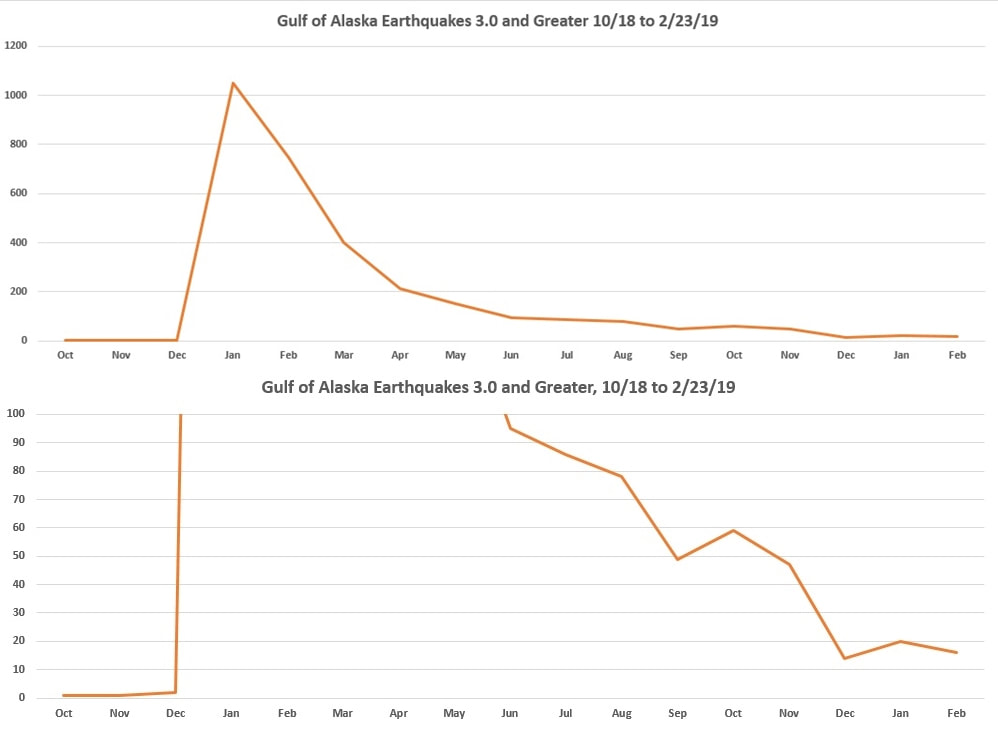
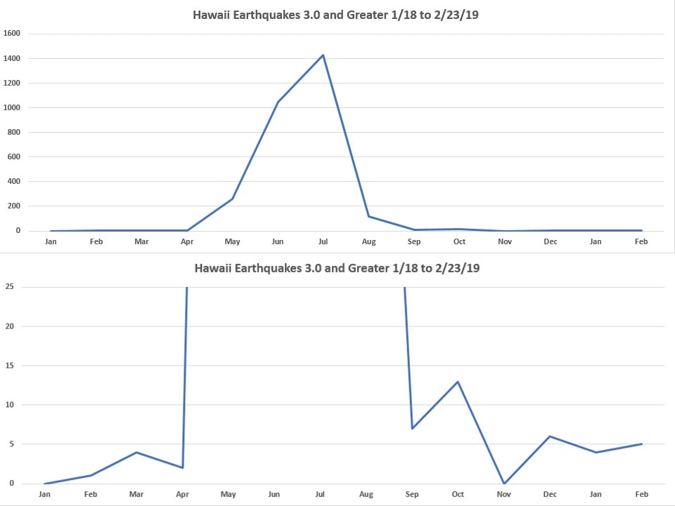
If your wondering where our snow and winter is coming from, here it is. Earthquakes and Volcanoes work together, but deep sea eruptions can not be monitored visually, but their condition can be assessed through earthquake data. Volcanoes erupt releasing massive amounts of pressure, and later they settle down and often seal. Due to the destabilization, they can easily erupt again but usually takes time to build in pressure, and sometimes they just continue to flow, like Hawaii. This is also demonstrated by the number of earthquakes before and after the event. These are two of many regions expelling massive amounts of heat into the Pacific Ocean impacting our weather short term. Hawaii has settled down, while Alaska still rumbles but is demonstrating a slow decline. Expect the SW of the US to heat up this year!
0 Comments
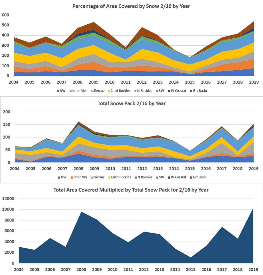
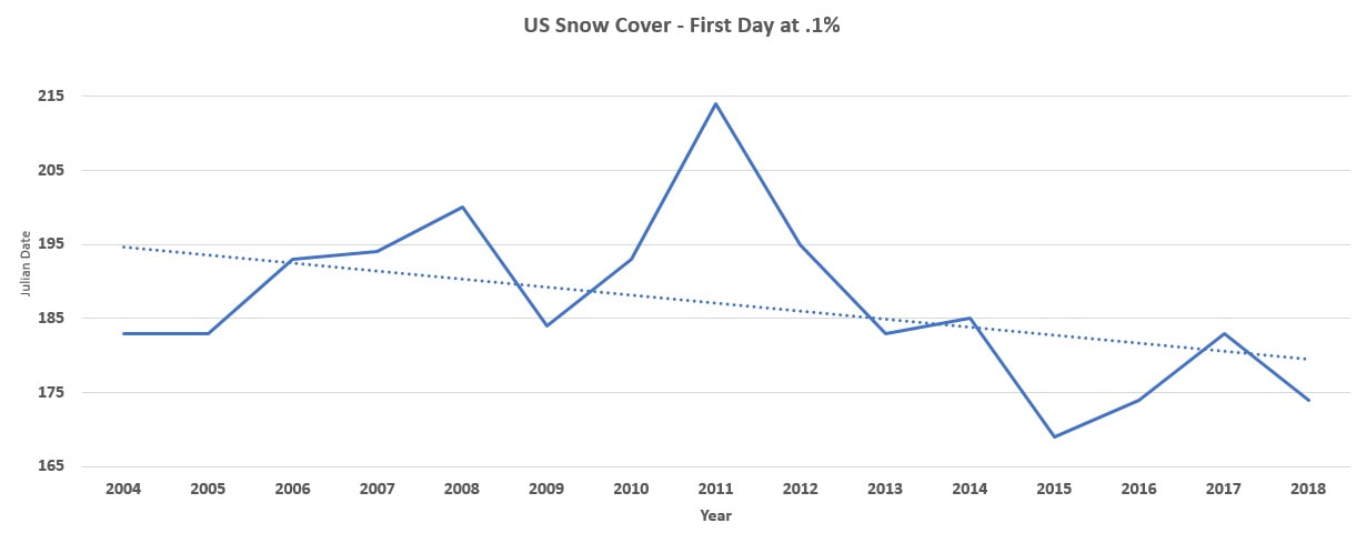
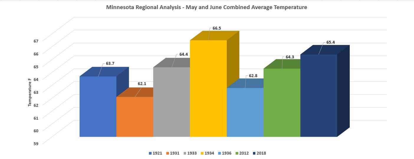
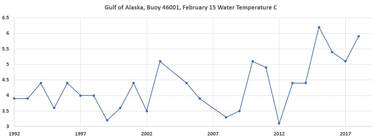 The Gulf of Alaska is a primary force providing the North American Continent with precipitation. I have been keeping track of buoy 46001 and current temperatures on 2/15/19 are the average temperatures once experienced in May, 3 months premature. This is promoting the snow like last year, and the longer it stays on the ground the longer the spring melt is delayed keeping lower than normal surface temperatures, last year we hit record heat when it lifted in May and June. In 2015, the only year that exceeded current temperatures, the heat and drought spread during the summer to the SW, along with fires. Last fall I had reported that the warm ocean current would bring in massive snow pack into the Rockies resulting in massive flooding this spring, the size of the flood can now be compared to previous seasons. The snow pack in the Rockies is at an all time high since recording began in 2004, and this includes the 2008 great flood. Our current snow pack is going to increase the local water tables, and all of this snow will find it's way towards the Mississippi. With the exception of the US SW region, all regions out west are above average levels, and some bursting. Here are all 8 regions out west and all of this will be heading east within the next few months. There is no way around it, it's a tsunami scale flood on the horizon. What is going to make this season worse than 2008 is that since 2013 the snow pack in the Rockies is dissipating at a far more rapid pace, meaning more water at a faster pace. This graph demonstrates the first day when snow pack reaches .1%, which is the last remaining snow in the Northern Rockies and is now melting 2 weeks earlier than previous years. When the air temperatures rise over the Gulf of Alaska, precipitation will decline as it did in 2015, but not until. The current North America snow pack is going to maintain a cool atmosphere short term, but by the end of April we will begin to see the showers and water levels rise. Last year we followed a similar pattern, but was followed by one of the hottest May and Junes on record. In the chart below we can see how May and June stacked up against other years across the entire state of Minnesota.
|
Archives
September 2019
Categories |
 RSS Feed