|
Searching Earthquakes 3.0 and greater, 36km maximum depth in this region of the Gulf of Alaska. There have been more 3.0 level earthquakes in this region in less than 3 months than has been experienced in 26 years. From 1970 to 1996 there were 2,084 earthquakes in this top image, in the bottom image we have had 2,090 since January 1. Prior to this year the maximum was 394 in 2012. 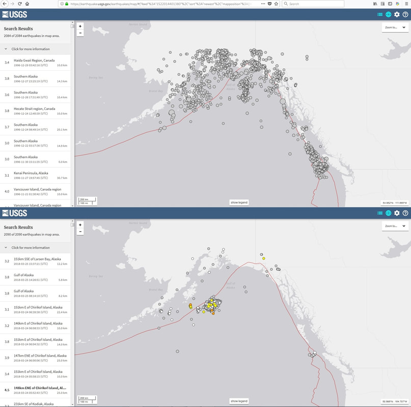 In the following image is the surface water temperatures in the Gulf of Alaska, all other buoys are demonstrating the same rise in surface water temperatures since 2012. This is also the same time frame when subterranean aquifers began pulsing heat into the territorial waters, a sign of the aquifers coming to thermal equilibrium with the bedrock. Now the seas are demonstrating the same rise. 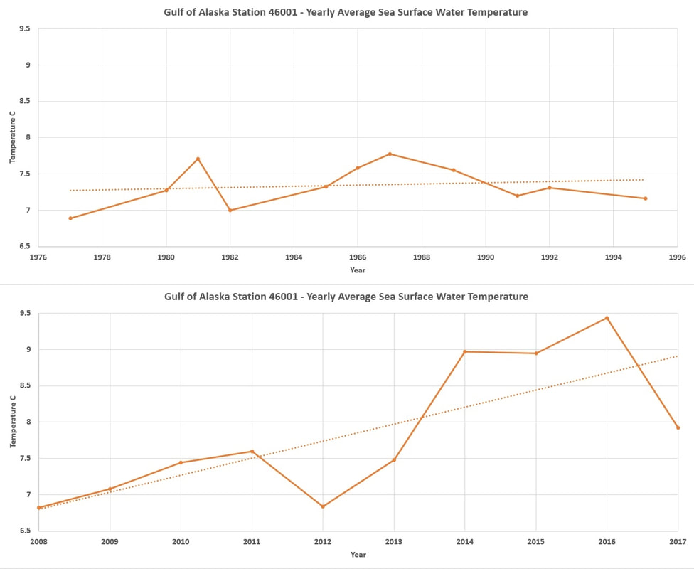
0 Comments
Leave a Reply. |
Archives
September 2019
Categories |
 RSS Feed